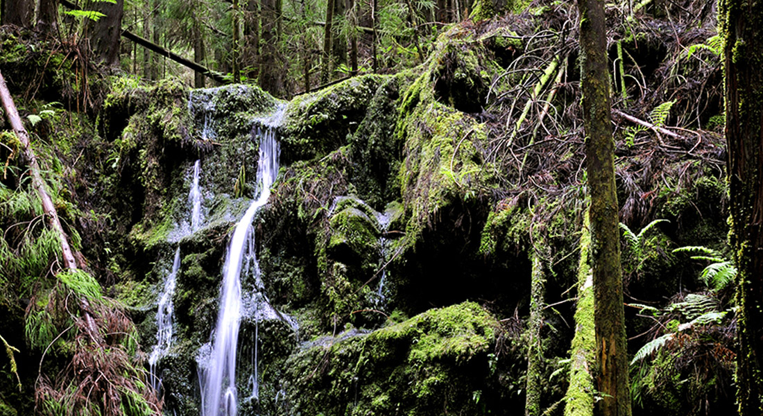
The Levada, qualified as “the greatest engineering work of the Azores” on its inauguration day, took seven years to plan and four to construct. It is a water channel installed at 680 metres high, which main function was the hydroelectric power production. Throughout its 10 kilometres, the ditch collected water from the Castelhano, Cabeço, Risco, Fajãs, Cabras, Guarda-Sol and Águas Claras zones, later channelled from the main reservoir, with 1000 m3 storage capacity, to the mini hydric central of Varadouro.
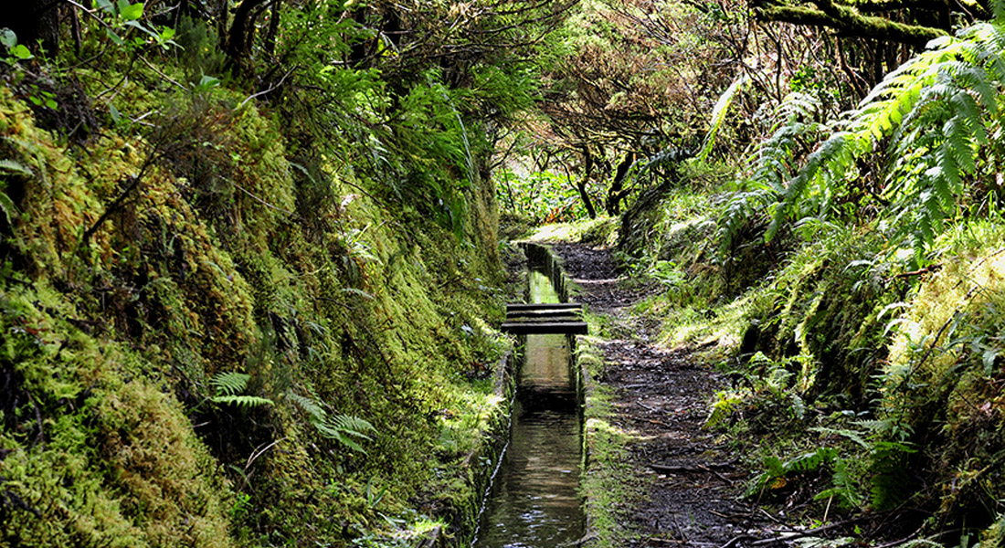
Partially inserted in the Zona Central Protected Landscape Area, this trail develops along 8 kilometres of a levada (irrigation channel) and reveals areas of great volcanological interest, passing through the Península do Capelo geosite, and great diversity of fauna and flora species of the Laurel Forest. Sometimes, clearings open up along the trail, which will allow you to view the alignment of the volcanic cones of the Capelo Volcanic Complex. Continue through endemic vegetation such as Laurus azorica, Frangula azorica, Ilex azorica, Erica azorica, among others. It is also possible to see some birds from the Azores, such as the Turdus merula azorensis, the Regulus regulus inermis, and the Fringilla coelebs moreletti.
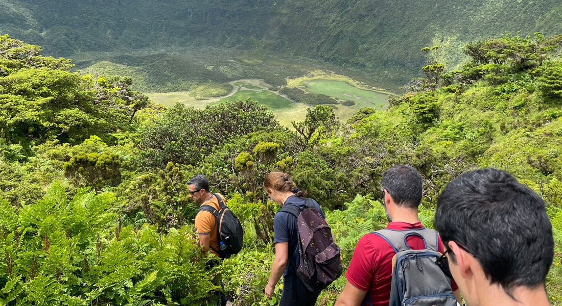
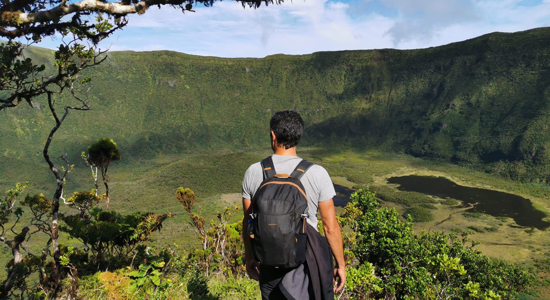
A Caldeira do Faial é uma reserva natural muito especial desde 1972 (categoria I – IUCN). É uma cratera de colapso vulcânico com características únicas. A descida à Caldeira do Faial é uma experiência excepcional. Por isso o Parque Natural do Faial controla o seu acesso, emitindo as autorizações necessárias. É permitido ir com Guia certificado. O interior da Caldeira do Faial representa uma das manchas mais intactas de floresta nativa dos Açores. É um dos poucos sítios visitáveis, onde ainda se pode sentir, e imaginar como eram os Açores antes da presença humana. O trilho é de dificuldade difícil porque é muito estreito e íngreme. Em algumas zonas é preciso utilizar as mãos para progredir. É frequente encontrar lama e uma área alagada no fundo, uma vez que a Caldeira é considerada um habitat húmido.